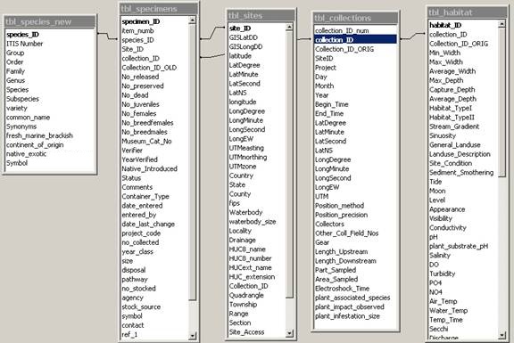
NAS Database
Relational
Structure:
SPECIMENS
|
specimen_ID |
AutoNumber |
unique number for this specimen |
|
item_numb |
Number |
NAS item number from old system |
|
species_ID |
Number |
unique species number |
|
Site_ID |
Number |
unique site number |
|
collection_ID |
Number |
unique collection number |
|
Collection_ID_OLD |
Text |
old collection number |
|
no_collected |
Number |
number of specimens collected |
|
No_released |
Number |
number released |
|
No_preserved |
Number |
number preserved |
|
No_dead |
Number |
number dead |
|
No_juveniles |
Number |
number of juveniles collected |
|
No_females |
Number |
number of females collected |
|
No_breedfemales |
Number |
number of breeding females collected |
|
No_breedmales |
Number |
number of breeding males collected |
|
Museum_Cat_No |
Text |
museum catalog number |
|
Verifier |
Text |
person who verified the identification |
|
YearVerified |
Number |
year the specimen was verified |
|
Previously_determined |
Text (120) |
Previous taxonomic determination |
|
Native_Introduced |
Text |
native or introduced to this location: Native, Introduced, Unknown |
|
Status |
Text |
reproductive status of the population: established, persisting, collected, reported, extirpated, failed, eradicated |
|
Comments |
Memo |
comments about this specimen |
|
Container_Type |
Text |
container where specimen is stored: jar; vial; tub |
|
date_entered |
Date/Time |
date current record is first entered |
|
entered_by |
Text |
initials of person entering current record |
|
date_last_change |
Date/Time |
timestamp of last change to curent record |
|
year_class |
Text |
adult juvenile fry |
|
size |
Text |
specimen size |
|
disposal |
Text |
fate of specimen; deposited in museum, eaten, released, etc.; for Plants name of herberium |
|
pathway |
Text |
Method of introduction; type_intro in tbl_NAS |
|
no_stocked |
Text |
number of individuals stocked or released |
|
agency |
Text |
agency responsible for introduction |
|
stock_source |
Text |
place where species came from most recently |
|
|
|
|
|
contact |
Text |
contact person for this record |
|
ref_1 |
Number |
published reference that is source for this record |
|
ref_2 |
Number |
additional supporting published references; or refs mentioned in ref_1 |
|
ref_3 |
Number |
additional supporting published references; or refs mentioned in ref_1 or ref_2 |
|
fresh_marine_intro |
Text |
introduced into fresh or marine waters? |
|
impact |
Memo |
known impacts of this introduced species at this site |
|
Record_type |
Text (25) |
Type of record (based on source): specimen; literature; personal communication; database |
|
Reproductive_status |
Text (20) |
Reproductive status of collected plant: flower; fruit; flower and fruit; spore bearing; vegetative |
|
Plant_ID_notes |
Text (250) |
Characters used to identify plant |
SITES
|
site_ID |
AutoNumber |
Unique number to identify site |
|
GISLatDD |
Number |
Decimal Degree Latitude in GIS system |
|
GISLongDD |
Number |
Decimal Degree Longitude in GIS system |
|
latitude |
Text |
degrees minutes seconds (imported from NAS) |
|
LatDegree |
Number |
record best position from actual collector GPS reading or map interpretation, can be different from Sites table GISLatitude |
|
LatMinute |
Number |
record best position from actual collector GPS reading or map interpretation, can be different from Sites table GISLatitude |
|
LatSecond |
Number |
record best position from actual collector GPS reading or map interpretation, can be different from Sites table GISLatitude |
|
LatNS |
Text |
Degrees north or south latitude |
|
longitude |
Text |
degrees minutes seconds (imported from NAS) |
|
LongDegree |
Number |
record best position from actual collector GPS reading or map interpretation, can be different from Sites table GISLatitude |
|
LongMinute |
Number |
record best position from actual collector GPS reading or map interpretation, can be different from Sites table GISLatitude |
|
LongSecond |
Number |
record best position from actual collector GPS reading or map interpretation, can be different from Sites table GISLatitude |
|
LongEW |
Text |
Degrees east or west longitude |
|
Lat/Long Source |
Text (20) |
Source of coordinates (GPS reading; map derived; |
|
UTMeasting |
Number |
Universal Transverse Mercator easting |
|
UTMnorthing |
Number |
Universal Transverse Mercator northing |
|
UTMzone |
Number |
Universal Transverse Mercator zone |
|
Country |
Text |
Country of occurrence; on borders, list each with a hyphen between names; query using *name* to include all borderline collections |
|
State |
Text |
State of occurrence; on borders, list each with a hyphen between names; query using *name* to include all borderline collections |
|
County |
Text |
County of occurrence; on borders, list each with a hyphen between names; query using *name* to include all borderline collections |
|
fips |
Number |
Unique 5 digit number for state and county |
|
Waterbody |
Text |
Name of waterbody where collection was made, use "unnamed tributary to next named waterbody" for unknown |
|
waterbody_size |
Text |
waterbody size in acres |
|
Locality |
Text |
verbal description of site, ca = about, SR = state route, mi = miles, jnct = junction, |
|
Drainage |
Text |
name of basin-drainage-watershed or name of next largest waterbody for estuarine/marine collections |
|
HUC8_name |
Text |
drainage as hydrologic unit code 8 digit name |
|
HUC8_number |
Number |
hydrologic unit code (8 digits) |
|
HUCext_name |
Text |
hydrologic unit code extension name to the smallest described area |
|
HUC_extension |
Number |
hydrologic unit code extension (number of digits varies from state to state) |
|
Collection_ID |
Text |
field number where site location information is described |
|
Quadrangle |
Text |
US Geological Survey 7.5 minute quadrangle name |
|
Township |
Text |
township number and bearing (i.e., 23 N) |
|
Range |
Text |
range number and bearing (i.e., 12 W) |
|
Section |
Text |
section number and quarter section (i.e., 36 NE) |
|
Site_Access |
Text |
how sample site was accessed (i.e., foot, boat, at boat ramp) |
|
Remarks |
Memo |
notes that pertain to location only |
|
Site_equals |
Number |
if this site is the same as another what is the SiteID for that other site. |
|
GISCODE |
Number |
the precision of the location information, state=1, county=2, drainage=3, point=4, state and drainage=6, county and drainage=7, state and lake=8, county and lake=9, state and linear=10, county and linear=11, bay=12, area of county=13, area of state=14 |
|
Protected_area |
Text 20 |
Combo box (Yes-Federal; Yes-Other; No (default)) |
SPECIES
|
species_ID |
AutoNumber |
arbitrary unique number (because not all have ITIS numbers yet) |
|
ITIS Number |
Number |
Taxonomic serial number ( |
|
Group |
Text |
Algae, Annelids, Bryozoans, Jellyfish, Fishes, Crabs, Bivalves, Snails, Tunicates, Plants, Sponges (see complete list) |
|
Order |
Text |
Taxonomic order - according to ITIS |
|
Family |
Text |
Taxonomic family - according to ITIS |
|
Genus |
Text |
Taxonomic genus - according to ITIS |
|
Species |
Text |
Taxonomic species - according to ITIS |
|
Subspecies |
Text |
Taxonomic subspecies - according to ITIS |
|
variety |
Text |
for plants only |
|
common_name |
Text |
commonly accepted common/vernacular name |
|
Synonyms |
Text |
other scientific names |
|
fresh_marine_brackish |
Text |
does species occur in fresh, marine, or brackish water in its native range |
|
continent_of_origin |
Text |
continent/region of origin (native range) |
|
native_exotic |
Text |
Native, exotic/foreign or cryptogenic to the US |
COLLECTION
|
collection_ID_num |
Number |
field collector's number (from field notes) |
|
collection_ID |
AutoNumber |
arbitrary unique number |
|
Collection_ID_ORIG |
Text (100) |
Original collector/herbarium number |
|
SiteID |
Number |
unique number that corresponds to site record |
|
Project |
Text |
code given to project: NAS Animals, NAS Plants, EPA, Eglin |
|
Day |
Number |
day of collection |
|
Month |
Number |
month of collection |
|
Year |
Number |
year of collection |
|
Begin_Time |
Date/Time |
start time of collection |
|
End_Time |
Date/Time |
ending time of collection |
|
LatDegree |
Number |
Degrees of Latitude; recorded at site at time of collection |
|
LatMinute |
Number |
Minutes of Latitude; recorded at site at time of collection |
|
LatSecond |
Number |
Seconds of Latitude; recorded at site at time of collection |
|
LatNS |
Text |
North or South latitude |
|
LongDegree |
Number |
Degrees of Longitude; recorded at site at time of collection |
|
LongMinute |
Number |
Minutes of Longitude; recorded at site at time of collection |
|
LongSecond |
Number |
Seconds of Longitude; recorded at site at time of collection |
|
LongEW |
Text |
East or West Longitude |
|
UTM |
Text |
UTM position |
|
Position_method |
Text |
how were coordinates obtained: map, GPS |
|
Position_precision |
Text |
|
|
Collectors |
Text |
Names of collectors making collection |
|
Other_Coll_Field_Nos |
Text |
if collection recorded by more than one collector |
|
Gear |
Text |
gear used for collection: seine, electroshock, blocknet, angling |
|
Length_Upstream |
Number |
distance sampled upstream |
|
Length_Downstream |
Number |
distance sampled downstream |
|
Part_Sampled |
Text |
|
|
Area_Sampled |
Number |
|
|
Electroshock_Time |
Number |
length of time electroshocker was used in minutes |
|
plant_infestation_size |
Text |
size of area covered by non-native plant; give units |
Habitat
|
habitat_ID |
AutoNumber |
unique number |
|
collection_ID |
Number |
collection ID - FOREIGN KEY |
|
Collection_ID_ORIG |
Text |
original collection number listed on herbarium sheet; also contains database numbers originally assigned then changed (animals) |
|
Min_Width |
Number |
narrowest point sampled in meters |
|
Max_Width |
Number |
widest point sampled in meters |
|
Average_Width |
Number |
mean width of sampled area in meters |
|
Max_Depth |
Number |
maximum depth in sampled area in meters |
|
Capture_Depth |
Number |
maximum capture depth in meters |
|
Average_Depth |
Number |
mean depth of sampled area in meters |
|
Habitat_TypeI |
Text |
broad aquatic habitat from National Wetlands Inventory |
|
Habitat_TypeII |
Text |
specific aquatic habitat |
|
Stream_Gradient |
Text |
amount of drop per linear section |
|
Sinuosity |
Text |
amount of curvature of stream |
|
General_Landuse |
Text |
overall landuse that affects area sampled |
|
Landuse_Description |
Text |
specific landuse that affects area sampled (i.e., sewage outfall, mill effluent) |
|
Site_Condition |
Text |
condition of overall watershed that affects area sampled |
|
Sediment_Smothering |
Text |
slightly=light dusting, moderately=up to 1 cm thick, severe=bottom homogenous silt |
|
Tide |
Text |
phase of tide during sample |
|
Moon |
Text |
phase of moon |
|
Level |
Text |
amount of flow or water level |
|
Appearance |
Text |
general color of water |
|
Visibility |
Text |
water clarity; if shallow, estimate horizontal visibility |
|
Conductivity |
Number |
microsiemens/cm or micromhos/cm |
|
pH |
Number |
negative log10 of hydrogen-ion concentration |
|
Salinity |
Number |
in parts per thousand |
|
DO |
Number |
in milligrams per liter of parts per million |
|
Turbidity |
Number |
in nephelometric turbidity units (NTU) |
|
PO4 |
Number |
in parts per million |
|
NO4 |
Number |
in parts per million |
|
Air_Temp |
Number |
in centigrade(celsius) degrees |
|
Water_Temp |
Number |
in centigrade(celsius) degrees |
|
Temp_Time |
Date/Time |
time that temperatures taken in 24-hour time at local time zone and daylight savings (i.e., 15:32) |
|
Secchi |
Number |
in meters |
|
Discharge |
Number |
calculated discharge in cubic meters per second |
|
substrate_description |
Text |
general substrate description |
|
Minimum_Riparian_Buffer |
Number |
minimum width of riparian cover to shrubs/trees stature in sampled area |
|
Run |
Number |
percent of sampled area minimum 5% increments |
|
Riffle |
Number |
percent of sampled area minimum 5% increments |
|
Pool |
Number |
percent of sampled area minimum 5% increments |
|
Backwater |
Number |
percent of sampled area minimum 5% increments |
|
Canopy_Cover |
Number |
percent of sampled area covered by shrubs and trees |
|
soft_silt-mud |
Number |
percent of sampled area minimum 5% increments |
|
silt-sand_mix |
Number |
percent of sampled area minimum 5% increments |
|
sand |
Number |
percent of sampled area (0.125 - 1.9 mm) |
|
gravel |
Number |
percent of sampled area (2 - 63 mm) |
|
rubble |
Number |
percent of sampled area (64 - 256 mm) |
|
boulder |
Number |
percent of sampled area (>256 mm) |
|
bedrock/claypan |
Number |
percent of sampled area in flat bedrock or claypan |
|
bedrock_ledges/fissures |
Number |
percent of sampled area in bedrock with many crevices/ledges/fissures |
|
vegetation |
Number |
percent of sampled area with submergent or emergent plants |
|
shred_detritus/organics |
Number |
percent of sampled area |
|
leaves/sm_branches |
Number |
percent of sampled area |
|
logs |
Number |
percent of sampled area (total of above should equal 100) |
|
algae |
Number |
percent of sampled area by 5% minimum increments |
|
submergent |
Number |
percent of sampled area by 5% minimum increments |
|
emergent |
Number |
percent of sampled area by 5% minimum increments |
|
overhanging |
Number |
percent of sampled area by 5% minimum increments |
|
floating |
Number |
percent of sampled area by 5% minimum increments |
|
standing_trees |
Number |
percent of sampled area by 5% minimum increments (total of above should equal 100) |
|
Veg_Species |
Text (256) |
Plant associates; vegetation species in and around sampling area |
|
Notes |
Memo |
all notes pertaining to habitat and collection |
|
habitat_description |
Text (256) |
category of habitat; i.e., lake, stream, canal, pond, impoundment, ruderal, etc. |
|
control_notes |
Text (256) |
PLANT control notes |
|
plant_frequency |
Number |
PLANT frequency percentage |
|
plant_frequency_notes |
Text |
PLANT frequency notes |
|
plant_elevation |
Number |
PLANT elevation |
|
waterveloc |
Number |
measure of current in meters/second |