Lysimachia nummularia
(creeping jenny)
Plants
Exotic |
|
Common name: creeping jenny
Synonyms and Other Names: Lysimachia zawadzkii Wiesner, Moneywort; Creeping jenny; Twopenny grass; Centimorbia; Monnoyere; Wandering Jenny; Creeping charlie
Taxonomy: available through
www.itis.gov
Identification: Lysimachia nummularia is an herbaceous perennial. It is a low-growing, creeping ground cover which might form leafy mat. Roots where leaf nodes come in contact with the soil. This cultivar features rounded, slightly ruffled, yellow leaves (to 3/4" diameter). Profuse, cup-shaped, bright yellow flowers (to 3/4" across) appear in early summer. Stems - Repent, tp +40cm long (and sometimes much longer), herbaceous, multiple from the base, typically simple, with 4 wings from deccurent leaf tissue. Wings to 0.7mm broad, forming vertical grooves along the sides of the stems. Leaves - Opposite, petiolate. Petioles to +/-5mm long, glabrous, with a wide and shallow adaxial groove. Blades orbicular, to +/-2.5cm in diameter, glabrous, entire, somewhat cordate at the base, dark green above, lighter green below. Veins of the leaves impressed above, expressed below. Inflorescence - Single axillary flowers. Peduncles to +/-2cm long, erect, glabrous. Flowers - Petals typically 5 (sometimes 6), united at the very base and forming a small corolla tube. Tube to 1mm long. Free portion of petals glabrous, yellow, to +1.4cm long, 5-7mm broad, rounded at the apex, oblong-elliptic. Stamens 5(6), adnate at the base of the petals, erect, united at the base. Filaments yellow, broadest at the base and tapering to the apex, glandular puberulent, to 5mm long. Anthers yellow, to 2mm long. Ovary superior, green, glabrous, globose, 1.2mm in diameter. Style green, glabrous, 5mm long. Stigma small, purplish. Sepals 5(6), green, spreading, with the margins slightly revolute in the basal 1/2, ovate-lanceolate, acute to acuminate at the apex, to +/-7mm long, +/-5mm broad, glabrous.
It is in flower from May to August, and the seeds ripen from August to September. The flowers are hermaphrodite (have both male and female organs) and are pollinated by bees and flies. The plant is self-fertile.
Size: horizontal stems to 40cm+
Native Range: Eurasia.


|

Alaska |

Hawaii |

Puerto Rico &
Virgin Islands |

Guam Saipan |
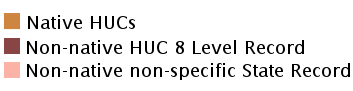
Hydrologic Unit Codes (HUCs) Explained
Interactive maps: Point Distribution Maps
Nonindigenous Occurrences:
Table 1. States with nonindigenous occurrences, the earliest and latest observations in each state, and the tally and names of HUCs with observations†. Names and dates are hyperlinked to their relevant specimen records. The list of references for all nonindigenous occurrences of Lysimachia nummularia are found here.
Table last updated 5/25/2026
† Populations may not be currently present.
* HUCs are not listed for states where the observation(s) cannot be approximated to a HUC (e.g. state centroids or Canadian provinces).
Ecology: Habitats include stream banks, bottoms, seeps, fens, roadsides, ditches, woodland borders, thickets, moist areas of black soil prairies, cemeteries, and edges of yards (Campbell et al. 2010, Forest Service 2013). This species needs moist soils to grow (Missouri Botanical Garden 2012). It can grow in semi-shade (light woodland) or no shade (Missouri Botanical Garden 2012). Elevation ranges between 0-3280 feet. Lysimachia nummularia reproduces and vegetatively; plant fragments can flow downstream and develop into new plants (IPANE 2013, MISIN and MNFI 2013). As the stem grows horizontally along the ground, new roots develop at the stem nodes (IPANE 2013, Kennay and Fell 2011). North American populations are not known to produce seeds (IPANE 2013).
Moneywort remains green most of the year in the Great Lakes (Kennay and Fell 2011).
Means of Introduction: Deliberate release.
Status: Established where recorded.
Impact of Introduction: Thrives in damp soils which will often kill off other types of ground covers. It is likely too invasive for border fronts or areas adjacent to lawns.
References: (click for full references)
Campbell, S., P. Higman, B. Slaughter, and E. Schools. 2010. A Field Guide to Invasive Plants of Aquatic and Wetland Habitats for Michigan. Michigan DNRE, Michigan State University Extension, Michigan Natural Features Inventory. 90 pp.
Forest Service. 2013. Lysimachia nummularia. Available http://www.fs.fed.us/database/feis/plants/forb/lysnum/all.html. Accessed 2 May 2013.
Garden, M. B. 2012. Lysimachia nummularia 'Aurea'. Available http://www.missouribotanicalgarden.org/gardens-gardening/your-garden/plant-finder/plant-details/kc/t120/lysimachia-nummularia-aurea.aspx. Accessed 2 May 2013.
Indiana Natural Hertiage Database. 2011. Illinios Threatened and Endangered Species by County. 126 pp.
Invasive Plant Atlas of New England (IPANE). 2013. Moneywort Lysimachia nummularia L. Available http://www.eddmaps.org/ipane/ipanespecies/herbs/lysimachia_nummularia.htm. Accessed 2 May 2013.
Kennay, J. and G. Fell. 2011. VEGETATION MANAGEMENT GUIDELINE: Moneywort (Lysimachia nummularia). Illinois Natural History Survey; Prairie Research Institute. Available http://www.inhs.illinois.edu/research/VMG/moneywort.html. Accessed 2 May 2013.
Midwest Invasive Species Information Newtork (MISIN) and Michigan Natural Features Inventory (MNFI). 2013. Moneywort (Lysimachia nummularia). Available http://www.misin.msu.edu/facts/detail.php?id=178. Accessed 2 May 2013.
New York Invasive Species Council. 2010. Final report: a regulatory system for non-native species. Department of Environmental Conservation, Albany, NY. 131 pp.
Ownbey, G.B., and T. Morley. 1991. Vascular plants of Minnesota. A checklist and atlas. University of Minnesota Press. Minneapolis
Seymour, F.C. 1969. The flora of New England. Charles E. Tuttle Company.
Rutland Smith, E.B. 1988. An atlas and annotated list of the vascular plants of Arkansas, 2d ed.
Thomas, R.D., and C.M. Allen. 1997. Atlas of the vascular flora of Louisiana, Vols. 1-3 Louisiana Department of Wildlife and Fisheries. Natural Heritage Program. Baton Rouge
Author:
Cao, L, and L. Berent
Revision Date: 4/30/2026
Citation Information:
Cao, L, and L. Berent, 2026, Lysimachia nummularia L.: U.S. Geological Survey, Nonindigenous Aquatic Species Database, Gainesville, FL, https://nas.er.usgs.gov/queries/FactSheet.aspx?SpeciesID=2680, Revision Date: 4/30/2026, Access Date: 5/25/2026
This information is preliminary or provisional and is subject to revision. It is being provided to meet the need for timely best science. The information has not received final approval by the U.S. Geological Survey (USGS) and is provided on the condition that neither the USGS nor the U.S. Government shall be held liable for any damages resulting from the authorized or unauthorized use of the information.