Flood and Storm Tracker (FaST) Maps
These maps were created to help assess impacts on nonindigenous aquatic species distributions due to flooding associated with storms. Storm surge and flood events can assist expansion and distribution of nonindigenous aquatic species through connection of adjacent watersheds, backflow of water upstream of impoundments, increased downstream flow, and/or creation of freshwater bridges along coastal regions. These maps will help natural resource managers determine potential new locations for individual species, or to develop a watchlist of potential new species within a watershed.
 One Pager NAS FaST
Initial FaST Maps are generated within days of a storm. How we do this.
Revised FaST Maps are generated once actual flooding data becomes available. How we do this.
Final FaST Maps are generated one year after a storm. How we do this.
Historic FaST Maps are generated for select storm and flood events prior to 2017. How we do this.
Disclaimer: This information is preliminary or provisional and is subject to revision. It is being provided to meet the need for timely best science. The information has not received final approval by the U.S. Geological Survey (USGS) and is provided on the condition that neither the USGS nor the U.S. Government shall be held liable for any damages resulting from the authorized or unauthorized use of the information.
Storms
2023
2022
2021
2020
2019
2018
2017
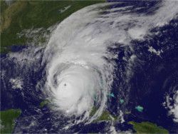
Hurricane Irma - Final map
Peninsular Florida and Atlantic coast of Georgia and South Carolina
September 3, 2017 - September 30, 2017

Historic
Hurricane images courtesy of NASA and NOAA
The refined NAS FaST map enhancement provides information only on the locations with flooding conditions that could breach drainage divides. We utilize information on the relative flood height using the best available data from the USGS Water Science Centers including stream gages, storm surge gages, inundation maps (when available), and identified high water marks along with National Oceanic and Atmospheric Administration modeled storm surge. This information is combined with information on the elevation of the hydrologic units at the 10-digit level (HUC-10s) boundaries (drainage divides) identified from digital elevation models. The flood elevation data was mapped with the hydrologic units' drainage divide elevations to determine if the flooding conditions were of sufficient height to breach the boundary. These "connection points" are identified along the hydrologic units' boundaries. Drainage divide connections determined by upstream stream gages at flood stages were assumed connected along streams and not given connection points on the map.
Hydrologic units identified as being flooded and potentially connected as part of the refined NAS FaST map are established based on the best available data. This map may not include all flooded areas. The refined NAS FaST map focuses on the potential spread of nonindigenous aquatic species between hydrologic units and is not a map of flood inundation.
Historic USGS NAS FaST maps represent the potential spread of established, non-native aquatic species by flood waters at drainage divides one year after a major storm that occurred prior to 2017. Areas impacted by flooding are defined by 10-digit Hydrologic Unit Codes (HUC10) that contain flood elevation data, including high water marks and storm tide sensors, from the USGS Flood Event Viewer (stn.wim.usgs.gov/fev/). These data are compared to USGS Digital Elevation Model (DEM) data (www.usgs.gov/core-science-systems/ngp/3dep) at HUC10 boundaries to assess the potential inundation at drainage divides. Areas where flood heights are greater than DEM heights at drainage divides are labeled “connection points” where aquatic species may have a potential corridor for temporary movement. Observations of established populations from the USGS NAS database (nas.er.usgs.gov) are mapped in areas determined as impacted by flood waters. Each HUC10 within the flood-impacted area is labeled either as “present in the watershed” if the population was established prior to the flood being mapped or as “potential spread due to flooding” if that HUC10 shares a connection point on a drainage divide with a HUC10 that contains an established population of the same species. For validation of a species’ potential flood dispersal, established populations that were observed up to one year after a flood event are mapped as post-storm observations. These observations potentially arrived to that HUC10 by way of flood waters if they are new to that HUC10 and have a reasonable corridor by way of the mapped connection points.
Hydrologic units identified as being flooded and potentially connected as part of the historic USGS NAS FaST maps are determined based on the best available data. These maps may not include all flooded areas. The historic USGS NAS FaST maps focus on the potential spread of nonindigenous aquatic species between hydrologic units and are not maps of flood inundation.